• Skip to primary navigation
  • Skip to main content
  • Skip to footer
Eno River Association

Eno River Association

Protect. Advocate. Learn.

skink link to Eno Fest
  • Explore
    • Places
    • Activities
    • Events
  • Protect
    • Conservation
    • Stewardship
    • Advocacy
  • Learn
    • Education Programs
    • Plants and Animals
    • Culture and History
    • Diversity, Equity, Inclusion, and Access
    • Climate Change Statement
  • Festival
  • Get Involved
    • Donate
    • Volunteer
    • Join our Email List
  • Donate

Search Eno River Association

Hiking

Outdoor Recreation

There are over 55 miles of trails to explore along the Eno and Little Rivers. Check out this list of specific Trails And Access Areas. Some of the main areas for hiking include:

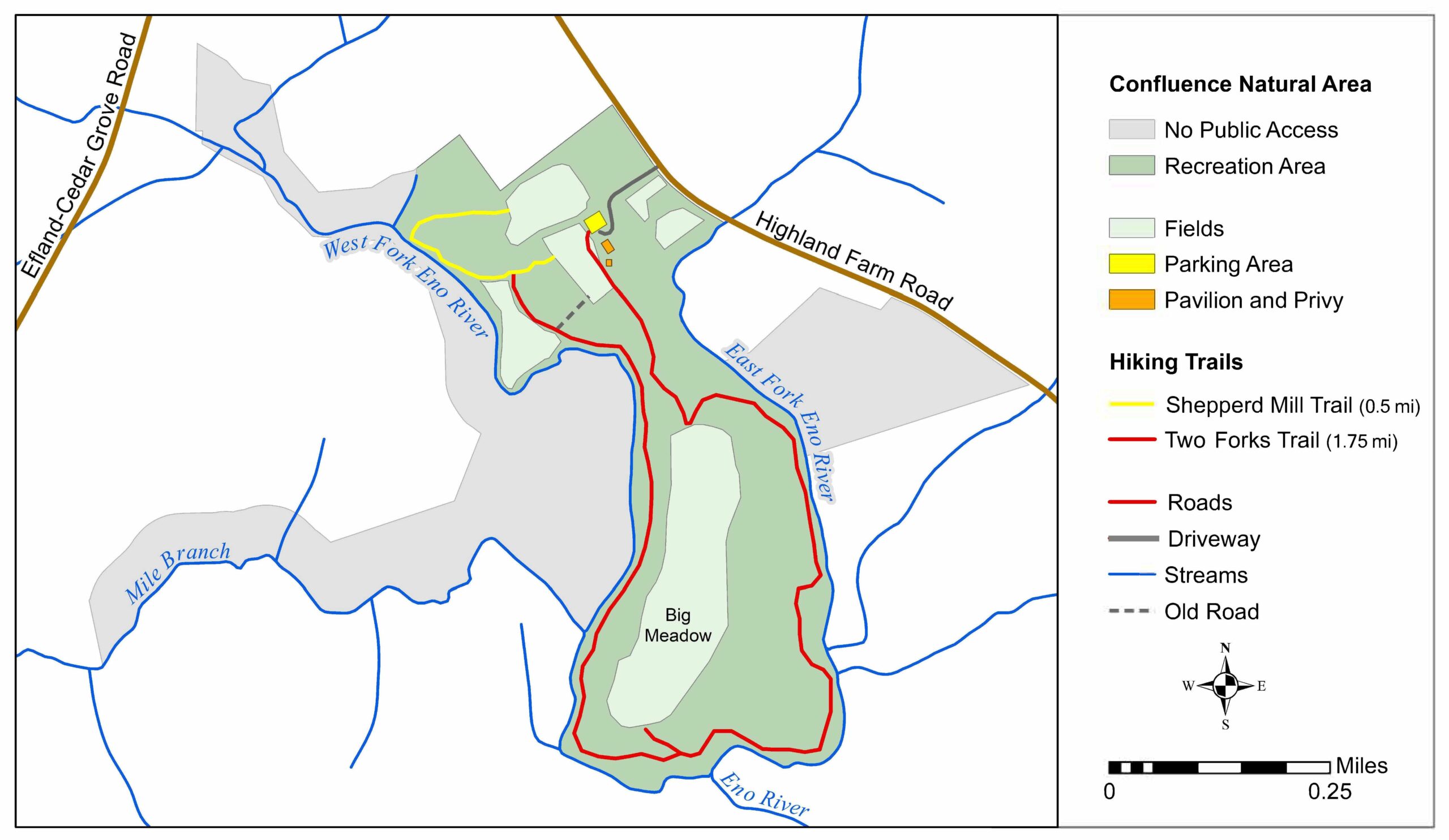
  • Confluence Natural Area (map)
  • Eno River State Park (hiking trails)
  • Historic Occoneechee Speedway / James M. Johnston Nature Preserve
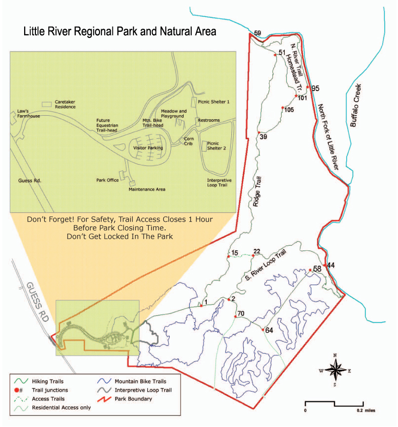
  • Little River Regional Park (map)
  • Mountains to Sea Trail (Segment 10)
  • Occoneechee Mountain State Natural Area (hiking trails)
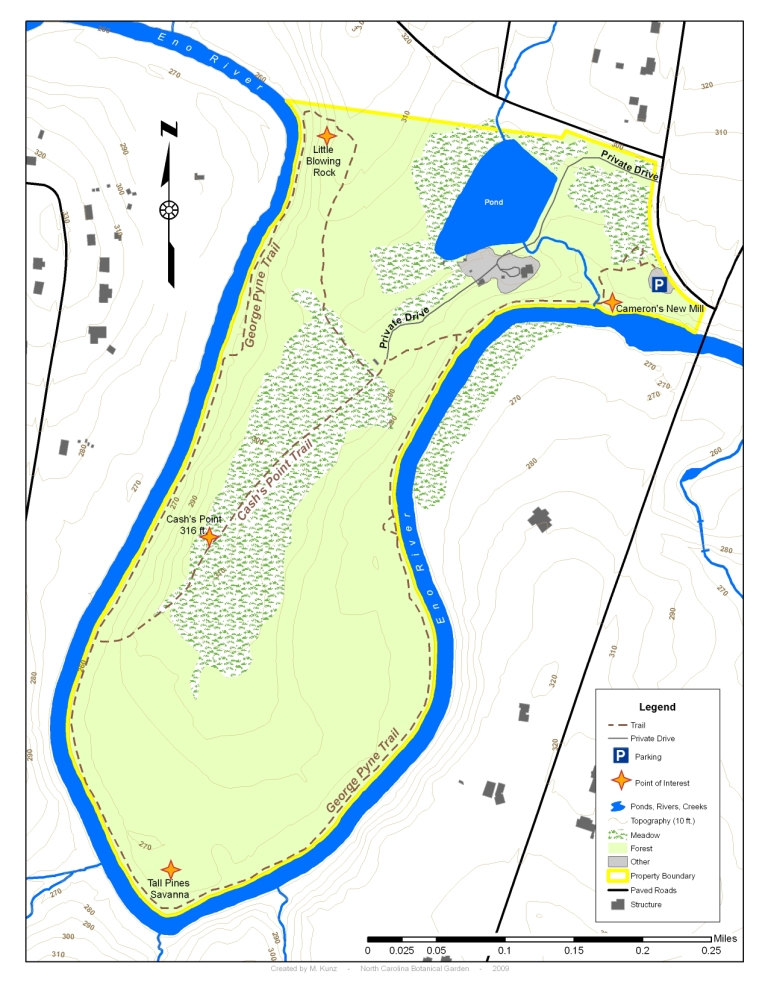
  • Pennys Bend Natural Area (map)
  • West Point on the Eno – Durham City Park (map)

New to hiking or to the Eno? Join us for one of our guided hikes, hosted every Sunday from January to May.

Related

Footer

Contact

Eno River Association
4404 Guess Rd.
Durham, NC 27712
(919) 620-9099

Become a Friend of the Eno

Join our Email List

Connect

  • Email
  • Facebook
  • Instagram
  • Twitter
  • YouTube

Key Links

  • About
  • News
  • Shop
  • Festival for the Eno
  • Board Login

Copyright © 2025 · Eno River Association · All Rights Reserved

Website by Code the Dream & Tomatillo Design